
Caer Caradoc
DATE 01.01.2018 | DISTANCE approx 7.2KM | HIGHEST POINT 459M
Posted by Matt | Filed under OtheR LOCATIONS
Download GPX file
A few weeks ago we ventured into shropshire, somewhere i know little about. we climbed wrekin which is located right next to the m54, a pretty straight-forward drive from home. From wrekin we could see some peaks over to the west which looked interesting. turns out one of them was caer caradoc. i little bit of research online and we had a new route to aim our sights on. So, the day arrived to explore another area in shropshire, only this time, we were unfortunate to choose a day shortly after a lot of snow and rainfall. this made for one heck of a boggy experience. it was so boggy that we had to abandon the initial 9 mile route and made for a direct ascent of caer caradoc. It was still pleasant as the rain stopped and the sun broke through as we reached the summit. definitely going back here sometime! maybe summer would be best next time!
After parking up near the train station we crossed back over the main road and headed for caer caradoc

this is the path you veer off onto near the entrance to new house farm. unfortunately recent rainfall and snow have turned it into more of a stream with a very sloppy bed.

negotiating this path took some time. somehow though, we still had dry toes. very muddy already though!

slightly less boggy as we near the base of caer caradoc

the original route would have had us make a right turn into the woodland and following a swollen stream. it looked like more bog hopping than we were happy to deal with so, we abandoned that route and went for the track further up on the left which would take us directly up to caer caradoc summit.

a steep ascent burning all leg muscles! Here is the view south to helmeth hill and beyond

leveled out briefly and then began to climb gradually. must be near the top now.


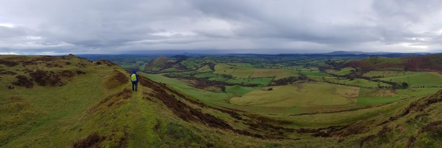
panoramic shot taken on my phone
the lawley in the distance and wrekin right at the back.


hint of a rainbow over haddon hill

following the hill back towards church stretton


approaching three fingers rock

looking down to church stretton. next up a very steep descent.
check the route and you will see we avoided that boggy path going back :)

